
Planning a Pool or Patio? Why a Topographic Survey Matters
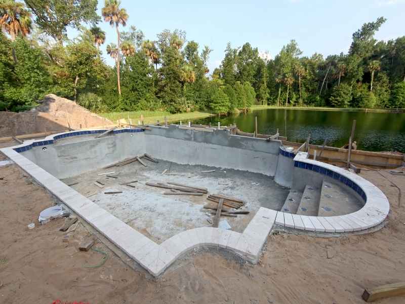
A backyard that looks flat to the eye rarely is. Walk it barefoot after rain and you’ll find the low spot fast. That hidden slope is exactly why a topographic survey should happen before a pool contractor breaks ground or a patio crew pours a single slab.
A topographic survey maps the elevations across a property. For a pool or patio project, that map becomes the difference between a design that works with the yard and one that fights it the whole way.
Map Existing Grades Before Choosing the Pool or Patio Location
Every yard has spots that sit higher or lower than others, even when the difference isn’t obvious while standing in it. A topographic survey records these elevation changes across the exact area where a pool or patio is being considered.
This data lets homeowners and designers compare a few different locations before locking anything in. One corner of the yard might sit on a gentle slope that would need extra grading. Another spot nearby might be nearly level already, which usually means less site work and lower cost.
Without this information, the location decision often comes down to guesswork or whatever looks flattest from the back door. A survey replaces that guess with real numbers.
Use Elevation Data to Set Pool, Patio, and House Relationships
Once a location is chosen, the next question is how it relates to everything else nearby. How high should the pool deck sit compared to the back door? Will the patio step down from the house or stay level with it? These questions depend entirely on accurate elevation data.
Survey information shows the exact height difference between the house, the yard, and the proposed pool or patio area. Designers use these numbers to plan steps, transitions, and deck heights that actually make sense on the ground, not just on paper.
Getting these vertical relationships right early avoids awkward outcomes later, like a patio door that opens onto a two-inch drop nobody planned for, or a pool deck that sits noticeably higher than the surrounding lawn.
Identify Where Excavation, Fill, or Grade Transitions May Be Needed
Contour lines on a topographic survey reveal patterns that aren’t visible just by walking the site. A pool excavation might need to cut deeper into a slope on one side and add fill on the other to level out the base. A patio might need a retaining edge where the ground drops off faster than expected.
Spotting these details before construction starts means the project budget and timeline can account for them from day one. Finding out about a major grade transition after equipment is already on site leads to delays, and often to unplanned costs that nobody wants to absorb midway through a build.
This kind of early planning keeps the project closer to its original scope. Fewer surprises during construction usually means a smoother project overall.
Plan Steps, Walls, and Transitions Around a Sloped Outdoor Area
Sloped yards aren’t a dealbreaker for a great pool or patio. They just need a plan that accounts for the slope instead of ignoring it. Topographic data helps identify exactly where steps, low walls, or terraced sections might fit naturally into the design.
A yard that drops several feet from the house to the back fence might call for a terraced patio with two or three level sections connected by steps. A pool built into a slope might need a retaining wall along one side to hold back the higher ground. These features work best when they’re planned around the property’s actual shape, not added as an afterthought once construction reveals a problem.
Good use of steps and transitions can turn a sloped yard into one of its most interesting features instead of its biggest obstacle.
Give the Designer and Contractor Better Existing-Site Information
Architects, landscape designers, pool contractors, and engineers all work faster and more accurately when they start with real site data. A topographic survey gives them exact elevations instead of rough estimates pulled from a walk around the yard.
This matters most when it comes to avoiding redesign. A layout built on incorrect assumptions about slope or elevation often needs revising once construction begins and the real conditions show up. That kind of mid-project change costs time and money that a survey could have prevented from the start.
Handing over accurate survey data at the beginning of a project sets everyone involved up to make better decisions the first time around.
Frequently Asked Questions
Why do I need a topographic survey before building a pool or patio?
It shows the exact elevation changes across your yard, which helps you choose the best location and avoid costly surprises once construction starts.
Can a topographic survey help decide where a pool should go?
Yes. It lets you compare different spots in the yard based on slope and elevation, so you can pick a location that needs less excavation or grading.
Will a topographic survey show if my yard needs retaining walls?
It can. Contour data often reveals where a slope is steep enough that a retaining wall or terraced design would work better than a single flat layout.
Does a sloped backyard mean I can’t build a pool or patio?
No. A sloped yard just needs a design that works with the slope, using steps, terraces, or retaining features identified through survey data.
How does a topographic survey help my contractor or designer?
It gives them accurate elevation numbers instead of guesses, which reduces the chance of redesigning the project once construction reveals the yard’s real shape.