
Planning an Addition? Know Your Property Boundaries First
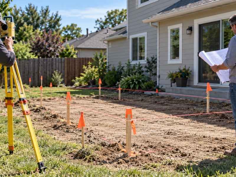
You have the design in your head. Maybe you even drew it on paper. But before a contractor starts digging, you need to know exactly where your property lines are.
Many homeowners think their fence, hedge or old survey stake marks the real boundary. It often doesn’t. Building even a foot too close to a property line can cause delays, cost you money, or start a fight with a neighbor.
A property survey gives you the facts before you spend money on plans and permits. Here’s what to check first, and why it matters more than most homeowners think.
Why Property Boundaries Matter Before Designing an Addition
Your property boundaries show where you can legally build. Without a current survey, you’re just guessing. You might rely on old records, a fence, or something the last owner told you.
Many older neighborhoods have boundary markers that moved, faded or vanished over time. If you build an addition without checking these lines, you could end up on your neighbor’s land or break a city setback rule.
A property survey finds your exact boundary lines. It uses legal records, recorded plats and real measurements on the ground. This gives your architect or designer solid facts to work from instead of a guess.
Skipping this is one of the most common and costly mistakes homeowners make. Fixing a mistake after construction costs far more than checking your boundaries before you start.
Common Boundary Issues That Affect Home Expansion Plans
Boundary problems show up more often than you’d expect. This is especially true on older lots or homes that changed owners many times.
Here are issues a property survey often finds:
- Fences built in the wrong spot. A fence from decades ago may sit several feet from the real line.
- Missing or buried markers. Iron pins get covered by dirt, mowed over, or removed during old construction work.
- Confusing legal records. Older deeds sometimes use vague language that doesn’t match how surveyors measure land today.
- Shared driveways. Some properties share a driveway or access point with no paperwork to prove it.
- Disputes with neighbors. Arguments often start when someone guesses a boundary based on landscaping instead of legal records.
Any of these problems can stop your project if they show up mid-construction instead of during planning. Finding them early saves you time, money and stress with your neighbors.
How Boundary Surveys Support Accurate Construction Planning
A boundary survey does more than mark your property lines. It gives your design and construction team solid facts to build from.
Once your surveyor marks the boundary lines, they can also show you the buildable area on your lot. This helps your architect design an addition that fits the rules from the start. You won’t have to make late changes after the city reviews your permit.
Surveyors also mark your existing buildings. This includes your house, garage, deck and any sheds. This matters because building departments often want site plans that show how your new addition relates to your current buildings and property lines.
A clear, professional survey means less back-and-forth with the city. Permit reviewers can approve your addition faster when your site plan uses real survey data instead of guesses.
What a Boundary Survey Typically Includes
Most home boundary surveys show:
- Property corners and boundary lines
- Existing buildings and how far they sit from the property line
- Easements on the lot
- Recorded right-of-way areas
Ask your surveyor which details apply to your property and project.
Reviewing Setbacks, Easements, and Site Restrictions Early
Setbacks and easements can limit where you’re allowed to build, even on a big lot.
A setback is the smallest distance a building must sit from your property line. Kansas City and nearby cities set their own setback rules. These rules can change based on your zoning district and lot type. Building inside a setback area, even by a little, can force you to redesign or remove part of your addition.
An easement gives someone else, like a utility company or a neighbor, the legal right to use part of your land for a specific reason. Common examples include:
- Utility easements for power lines, water pipes or sewer access
- Drainage easements that handle stormwater
- Shared access easements for driveways or private roads
You usually can’t build permanent structures inside an easement, even though you own that part of the land. A property survey shows you these areas so your design team can plan around them from day one.
Setback and easement rules can vary by city, county and zoning type. Check current rules with your local building department before you finalize your addition plans.
Coordinating Survey Information With Designers and Contractors
A survey only helps if the right people actually use it. Share your property survey with your architect, designer and contractor before they finish their plans.
This stops costly surprises during permitting or construction. Your architect can design within the confirmed boundaries and setbacks. Your contractor can plan the foundation, utility connections and grading based on real site facts instead of guesses.
If your project needs digging, ask if you need construction staking. This service marks the exact spot for your addition on the ground. It gives your contractor a clear guide to follow during construction.
Good teamwork between your surveyor, designer and contractor keeps your project on schedule. It also lowers the chance of costly changes caused by boundary or setback problems found mid-build.
Frequently Asked Questions
Do I need a new survey if I already have one from when I bought the house?
It depends on how old and detailed your survey is. Many lenders and cities want a current survey, especially if your old one is a few years old or doesn’t show enough detail for your addition. Check with your city or contractor before you rely on an old survey.
How long does a property survey take?
It depends on your property’s size, land shape and how busy the surveyor is. Simple home boundary surveys often take one to two weeks. Bigger or trickier properties can take longer. Ask your surveyor for a timeline based on your project.
What happens if my addition plans conflict with a setback or easement?
You may need to redesign the addition, ask your city for a variance, or change the size of your project. This is why checking survey details early, before you finish your design, saves you time and money.