↓
 

Kansas City Land Surveying

Local Land Surveyors in Kansas City, MO

Kansas City Land Surveying
  • Home
  • ALTA Survey
  • Boundary Surveying
  • Construction Survey
  • Drone LiDAR Mapping
  • Elevation Certificate
  • Land Surveying
  • Lot Survey – Closing Survey
  • Topographic Survey
  • Blog
  • Contact Us
Home 1 2 3 … 14 15 >>

Post navigation

← Older posts

Welcome to Kansas City Land Surveying

Kansas City Land Surveying Posted on August 18, 2017 by Kansas CitySurveyorMarch 24, 2020

Your Final Stop for ALL of Your Survey Needs!                                         Contact us today for a free quote!

This site is intended to provide you with information on Land Surveying in the Kansas City, MO and Jackson area of Missouri. If you’re looking for a Kansas City Land Surveyor, you’ve come to the right place. If you’d rather talk to someone about your land surveying needs, please call our local number at (816) 325 3819 today. For more information, please continue to read.

land surveyingLand Surveyors are professionals who make precise measurements to determine the size and boundaries of a piece of real estate.  While this is a simplistic definition, boundary surveying is one of the most common types of surveying related to home and land owners. If you fall into the following categories, please click on the appropriate link for more information on that subject:

Kansas City Land Surveying services:

    1. I need to know where my property corners or property lines are. (Boundary Survey)
    2. I have a loan closing or re-finance coming up on my home in a subdivision. (Lot Survey)
    3. I need a map of my property with contour lines to show elevation differences for my architect or engineer. (Topo Survey)
    4. I’ve just been told I’m in a flood zone or I’ve been told I need an elevation certificate in order to obtain flood insurance or prove I don’t need it. (Flood Survey)
    5. I’m purchasing a lot/house in a recorded subdivision. (Lot Survey – See Boundary Survey if you’re not in a subdivision.)
    6. I’m purchasing a larger tract of land, acreage, that hasn’t been subdivided in the past. (Boundary Survey)

Contact Kansas City Land Surveying services TODAY at (816) 325 3819.

Posted in boundary surveying, elevation certificate, land surveying, land surveyor | Tagged boundary survey, Kansas City Land Surveying, land surveyor, land surveyor kansas-city mo

When Does a Project Need a Construction Surveyor?

Kansas City Land Surveying Posted on October 1, 2026 by Kansas CitySurveyorSeptember 28, 2026
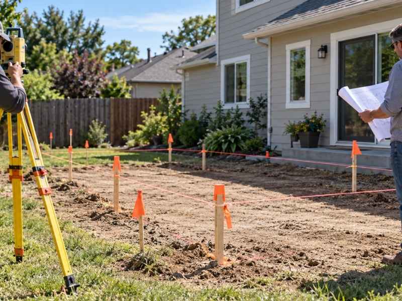
Construction surveyor performing site layout for a building project in Kansas City Missouri

Most layout mistakes are cheap to fix on day one and expensive by week ten. A footing set two feet off, a sewer line laid at the wrong slope, or a curb built outside the right-of-way can mean tear-outs, delays, and hard talks with the owner. The right construction surveyor, brought in at the right times, keeps those errors from reaching concrete.

A construction surveyor is a licensed surveyor, or a crew working under one, who places design points on the ground and checks that the work matches the plans. This guide is written for contractors, developers, and owners managing a build. The main takeaway is simple. Plan survey visits around your schedule from the start, instead of calling for help once something already looks wrong.

Project Stages That May Require a Construction Surveyor

Most projects need survey support at several points during the build. The exact list depends on project type, size, and what the contract and permits call for. A single-family home may need only a few visits, while a commercial site can need a crew out every week.

Typical stages that call for survey work include:

  • Before construction, to set control and confirm existing conditions
  • During clearing and rough grading
  • For underground utilities and storm structures
  • At foundations and building corners
  • For curbs, paving, and final grades
  • At closeout, for as-built records

Not every job needs every stage. Ask your surveyor to review the plans and bid documents and tell you which visits make sense. That conversation is much easier before the schedule is locked.

When Design Plans Must Be Transferred to the Site

The first clear trigger is layout. Once plans are approved and you’re ready to move dirt, a construction surveyor turns drawings into physical marks on the ground. This work is called construction staking.

Setting Survey Control

Before staking starts, the surveyor sets control points. These are stable, measured reference points placed around the site, away from heavy equipment traffic. Every stake that follows ties back to them, so the whole job stays on one consistent frame.

Checking the Plans Before Staking

A careful surveyor also checks the plans against the site. Dimensions that don’t close, elevations that don’t match existing grades, or a building that crowds a setback line can all show up here. Finding those conflicts before crews start digging is one of the cheapest fixes on any project.

Survey Needs as Site Work and Building Progress

As work moves forward, the surveyor’s role grows from layout into layout plus checking. Each phase has its own points to stake and verify. Crews work faster when the marks they need are already in place before they arrive.

During grading, stakes show cut and fill depths so operators know how much soil to remove or add. For utilities, the surveyor marks pipe locations and flow line elevations, which set the slope water will follow. On the building itself, the focus shifts to foundation corners, column lines, anchor bolts, and finished floor elevations.

Many contractors ask for a check after forms are set and before concrete is poured. It takes little time and catches errors while they’re still easy to correct. Some jurisdictions or lenders may also ask for a foundation location survey at this point, so confirm the requirement with your permit office or lender.

When Field Changes Require Updated Survey Measurements

Plans rarely make it through a project unchanged. A buried utility turns up where nobody expected it. An owner moves an entrance, or the engineer revises a storm structure after review.

Each of these changes can affect points that were already staked. Call the construction surveyor whenever a revision touches locations, elevations, or grades. Building from old stakes after a plan change is one of the most common causes of rework.

Stakes also get lost. Equipment knocks them over, weather washes them out, and grading buries them. If key marks are gone or look disturbed, ask for them to be reset instead of guessing from nearby points. Keep a record of every field change too, because it will matter when the as-built survey is prepared.

Planning Survey Support Around Construction Milestones

The best way to use a construction surveyor is to plan visits around the milestones already on your schedule. Pair survey requests with events like grading start, utility installation, foundation pours, and paving. That way crews aren’t left standing around waiting for layout.

Give the survey team clear notice. Many firms need a few days to schedule a crew, and busy seasons can stretch that lead time. On larger jobs, a standing weekly visit often works better than scattered calls.

Plan for closeout early. An as-built survey records what was actually built, including building locations, utilities, and final grades. Some municipalities, lenders, or owners require one before final approval or payment, and the rules vary by jurisdiction and project scope. Ask about as-built needs at the start so the surveyor can collect data as the work goes in.

Posted in construction | Tagged construction survey

Planning an Addition? Know Your Property Boundaries First

Kansas City Land Surveying Posted on September 24, 2026 by Kansas CitySurveyorSeptember 30, 2026
Property survey for a home addition, Kansas City, Missouri

You have the design in your head. Maybe you even drew it on paper. But before a contractor starts digging, you need to know exactly where your property lines are.

Many homeowners think their fence, hedge or old survey stake marks the real boundary. It often doesn’t. Building even a foot too close to a property line can cause delays, cost you money, or start a fight with a neighbor.

A property survey gives you the facts before you spend money on plans and permits. Here’s what to check first, and why it matters more than most homeowners think.

Why Property Boundaries Matter Before Designing an Addition

Your property boundaries show where you can legally build. Without a current survey, you’re just guessing. You might rely on old records, a fence, or something the last owner told you.

Many older neighborhoods have boundary markers that moved, faded or vanished over time. If you build an addition without checking these lines, you could end up on your neighbor’s land or break a city setback rule.

A property survey finds your exact boundary lines. It uses legal records, recorded plats and real measurements on the ground. This gives your architect or designer solid facts to work from instead of a guess.

Skipping this is one of the most common and costly mistakes homeowners make. Fixing a mistake after construction costs far more than checking your boundaries before you start.

Common Boundary Issues That Affect Home Expansion Plans

Boundary problems show up more often than you’d expect. This is especially true on older lots or homes that changed owners many times.

Here are issues a property survey often finds:

  • Fences built in the wrong spot. A fence from decades ago may sit several feet from the real line.
  • Missing or buried markers. Iron pins get covered by dirt, mowed over, or removed during old construction work.
  • Confusing legal records. Older deeds sometimes use vague language that doesn’t match how surveyors measure land today.
  • Shared driveways. Some properties share a driveway or access point with no paperwork to prove it.
  • Disputes with neighbors. Arguments often start when someone guesses a boundary based on landscaping instead of legal records.

Any of these problems can stop your project if they show up mid-construction instead of during planning. Finding them early saves you time, money and stress with your neighbors.

How Boundary Surveys Support Accurate Construction Planning

A boundary survey does more than mark your property lines. It gives your design and construction team solid facts to build from.

Once your surveyor marks the boundary lines, they can also show you the buildable area on your lot. This helps your architect design an addition that fits the rules from the start. You won’t have to make late changes after the city reviews your permit.

Surveyors also mark your existing buildings. This includes your house, garage, deck and any sheds. This matters because building departments often want site plans that show how your new addition relates to your current buildings and property lines.

A clear, professional survey means less back-and-forth with the city. Permit reviewers can approve your addition faster when your site plan uses real survey data instead of guesses.

What a Boundary Survey Typically Includes

Most home boundary surveys show:

  • Property corners and boundary lines
  • Existing buildings and how far they sit from the property line
  • Easements on the lot
  • Recorded right-of-way areas

Ask your surveyor which details apply to your property and project.

Reviewing Setbacks, Easements, and Site Restrictions Early

Setbacks and easements can limit where you’re allowed to build, even on a big lot.

A setback is the smallest distance a building must sit from your property line. Kansas City and nearby cities set their own setback rules. These rules can change based on your zoning district and lot type. Building inside a setback area, even by a little, can force you to redesign or remove part of your addition.

An easement gives someone else, like a utility company or a neighbor, the legal right to use part of your land for a specific reason. Common examples include:

  • Utility easements for power lines, water pipes or sewer access
  • Drainage easements that handle stormwater
  • Shared access easements for driveways or private roads

You usually can’t build permanent structures inside an easement, even though you own that part of the land. A property survey shows you these areas so your design team can plan around them from day one.

Setback and easement rules can vary by city, county and zoning type. Check current rules with your local building department before you finalize your addition plans.

Coordinating Survey Information With Designers and Contractors

A survey only helps if the right people actually use it. Share your property survey with your architect, designer and contractor before they finish their plans.

This stops costly surprises during permitting or construction. Your architect can design within the confirmed boundaries and setbacks. Your contractor can plan the foundation, utility connections and grading based on real site facts instead of guesses.

If your project needs digging, ask if you need construction staking. This service marks the exact spot for your addition on the ground. It gives your contractor a clear guide to follow during construction.

Good teamwork between your surveyor, designer and contractor keeps your project on schedule. It also lowers the chance of costly changes caused by boundary or setback problems found mid-build.

Frequently Asked Questions

Do I need a new survey if I already have one from when I bought the house?

It depends on how old and detailed your survey is. Many lenders and cities want a current survey, especially if your old one is a few years old or doesn’t show enough detail for your addition. Check with your city or contractor before you rely on an old survey.

How long does a property survey take?

It depends on your property’s size, land shape and how busy the surveyor is. Simple home boundary surveys often take one to two weeks. Bigger or trickier properties can take longer. Ask your surveyor for a timeline based on your project.

What happens if my addition plans conflict with a setback or easement?

You may need to redesign the addition, ask your city for a variance, or change the size of your project. This is why checking survey details early, before you finish your design, saves you time and money.

Posted in boundary surveying | Tagged boundary survey

Top Reasons Homeowners Order Boundary Line Surveys

Kansas City Land Surveying Posted on September 17, 2026 by Kansas CitySurveyorSeptember 15, 2026
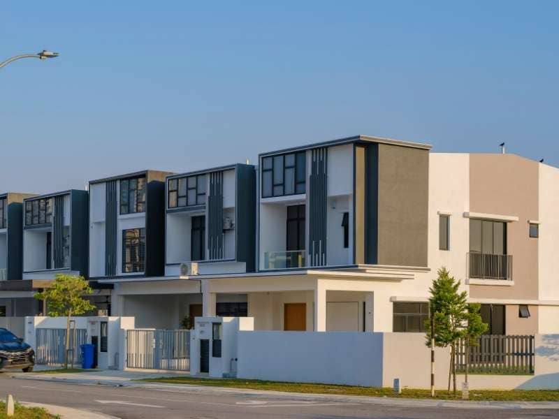
Boundary line survey for neighboring residential properties in Kansas City Missouri.

Most homeowners never think about their property lines. Then something forces the question. A new fence goes up next door. A tree falls near the edge of the yard. A lender asks for proof of the exact property lines before closing on a home sale.

A boundary line survey answers that question with facts. It does not rely on guesses. A licensed surveyor measures your lot. The surveyor checks it against old deeds. Then the surveyor marks the true corners on the ground.

makes this extra important. Older neighborhoods sit right next to new construction. Lot sizes change from block to block. That mix makes clear property lines even more valuable.

When Deeds and Property Maps Show Conflicting Information

A deed describes your property in legal language. It does not use GPS points. Older deeds often mention landmarks that no longer exist. This might be an old fence post, a bend in a creek, or a neighbor’s barn that was torn down years ago.

Sometimes two neighboring deeds describe the same boundary in different ways. One deed lists a distance that does not match the other deed. A plat map might show a slightly different shape than what the deed says in words.

This happens often in Jackson, Clay, and Platte County. Many properties there were divided into lots decades ago. This was before digital maps existed.

A boundary line survey fixes this problem. The surveyor checks the legal description against real evidence on the ground. This means the surveyor studies old deeds, easements, and past surveys. Then the surveyor finds monuments, iron pins, or other markers. These markers show where the real boundary sits.

If your deed and your neighbor’s deed do not match, do not try to figure it out on your own. Order a survey. Let a licensed professional trace the record back to where it started.

Clarifying Boundaries on Irregular or Older Residential Lots

Many lots are not simple rectangles. Corner lots are common. So are lots that back up to a creek. Older subdivisions were often platted before today’s zoning rules existed. This means many lots have odd angles or curved boundary lines.

Older lots also tend to be missing their markers. Original pins get buried under dirt. They get paved over during driveway work. They get pulled out during years of landscaping. Without a marker, a homeowner is often just guessing where the property actually ends.

A survey fixes this. The surveyor uses the original plat and the legal description to find the true boundary points again. This step matters a lot before you build a fence, plant a hedge along the property line, or put up a shed near the edge of your lot.

Ask your surveyor about these things early on:

  • Does your lot have a curved or irregular boundary?
  • Are there any visible corner markers?
  • Do you share a driveway or access path with a neighbor?
  • Is your lot close to a creek, floodplain, or drainage easement?

These situations show up often in older parts. They are also the exact situations where a boundary survey stops future arguments before they start.

Supporting Estate, Inheritance, and Family Property Transfers

Family property transfers bring their own boundary questions. This is especially true when land has stayed in the family for many years. A large parcel might have been split between family members long ago, without any official survey. A fence line might not match what the deed actually says.

A boundary line survey should happen before an estate transfer is finished. The survey confirms exactly what land is being passed down. It also confirms where the legal lines fall. This step protects everyone involved. It helps prevent future fights between siblings, heirs, or new owners.

A survey also helps when a large family property gets split into smaller parcels for different heirs. A surveyor can mark the current boundary. The surveyor can also propose new division lines if needed. Then the surveyor prepares the paperwork to record with the county.

Are you going through probate or an estate transfer in the area? Ask your attorney or title company if a current survey already exists. If it does not exist, or if it is old, ask for a new one before the transfer is complete.

Preparing for a Residential Lot Line Adjustment

A lot line adjustment moves the boundary between two properties next to each other. People request this for a few reasons. It might fix a small encroachment. It might allow the sale of a small piece of land. It might correct a long-standing gap between the deed and how the land is actually used.

This process usually starts with a new boundary survey. The survey documents the current lines. Then a plan is created for the new lines. Cities and counties in each have their own rules for lot line adjustments. These rules can change based on zoning, minimum lot size, and whether utilities are involved.

Do not assume a lot line adjustment will be simple. Check these things with your local planning department first:

  • Does the adjustment need a public hearing, or can staff approve it?
  • What are the minimum lot size and setback rules for your zoning district?
  • Will the change affect any utility easements?
  • What steps are needed to record the adjustment once it’s approved?

Rules can be different from one city or county to the next. Do not assume the same process will work the same way somewhere else in the metro. Confirm your survey and permit needs early, especially if a sale, a building project, or a closing date depends on getting the adjustment finished.

Resolving Title and Legal Description Discrepancies

Title problems tied to boundary lines can show up at almost any time. They tend to appear most often during a home sale. A title company checks the history of who has owned the property. Sometimes they find a legal description that does not match the current fence line. Sometimes they find an old easement that was never officially removed. Sometimes they find an overlap with the property next door.

These problems can slow down or even stop a closing if no one catches them early. A boundary line survey gives the title company, the lender, and the buyer a clear picture. It shows exactly where the property sits today, compared to what the legal paperwork says.

A survey often helps solve these common problems:

  • Two legal descriptions that overlap between neighboring lots
  • Fences, sheds, or driveways that cross onto another property
  • Easements that were never properly recorded or released
  • Gaps between the recorded plat and what’s actually built on the land

Are you buying, selling, or refinancing a property area? Ask your title company early if a current survey is already on file. If there isn’t one, or if it’s outdated, order a new one before closing. This can prevent surprises at the last minute.

Frequently Asked Questions

How long does a boundary line survey take? 

It depends on the size of the lot, the land itself, and how much research the property records need. A simple lot might only take a few days. Bigger or more complex lots can take longer. Ask your surveyor for a timeline based on your specific property.

How much does a boundary line survey cost?

The cost changes based on lot size, land conditions, how much of the boundary is unmarked, and how much deed research is needed. Get a quote for your own property instead of relying on a general price.

Do I need a survey if I already have a fence on my property line? 

Not always. But a fence does not guarantee it sits exactly on the legal line. Many fences were built based on a guess, not a survey. If you plan to rely on that fence for a sale, a building project, or a dispute, confirm the line with a current survey first.

Posted in boundary surveying | Tagged boundary survey

Post navigation

← Older posts
Get Quote Button
© Boxer Survey USA
Kansas City Land Surveying

Kansas City, Missouri
Phone: (816) 325 3819

Web Development and SEO by:
AuburnBusiness.com, LLC


Privacy Policy | Terms of Use

The owner of this website, Boxer Survey USA, provides coordination of professional land surveying and engineering services in all 50 states. The professional surveying and engineering services provided to you will be conducted by fully licensed professionals in your state.

↑